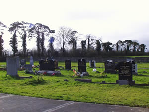
© New Graveyard in Bruree
The new graveyard in Bruree is in the townland of Garrouse
and was opened in 1981.
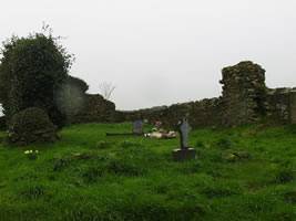
The remains of a castle are to be found in the graveyard
at Ballynoe. Lewis claims that the Knights Templars built this castle
in the 12th century but there is no other record to support his claim.
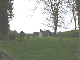
© Ballynoe graveyard
A pathway divides the graveyard in Ballynoe. Catholics
are buried on the right of the path and Protestants on the left of the
path. The oldest headstone that we found was to James Shea who died
on March 14th 1786 at the age of 22. However, from the book "Bruree"
by Mannix Joyce in 1972, a detailed list of all the headstones in the
graveyard is given. According to this list the oldest headstone in the
graveyard is to the memory of Mary Shanahan, who died on February 9th,
1771.
We also found the remains of a headstone that had a skull
and crossbones on it. As the headstone was broken, we do not know to
whom the headstone is. There was a tomb to the Lyons family in the graveyard
as well. The graveyard is kept in good condition.
© Howardstown graveyard
In Howardstown, there are a small number of graves. One
headstone of interest is to Robert O'Donnell. O'Donnell was a native
of the parish and was a member of the RAF in World War II. It is believed
that while flying a mission over Germany, he was shot down. His body
was never recovered but his wife erected a headstone to his memory in
his home parish.
Unbaptised children were buried at both Kilbreedy and
Killacolla in the past. According to the local historian, Jerry Hynes,
the site of Kilbreedy graveyard is located near the north-west corner
of a large pasture field about one mile west of the main Cork-Limerick
road, and 2 ½ miles west of Bruree. The field, locally known
as 'Church Field', is in the townland of Kilbreedy. It is probable that
there was once a church dedicated to St Brigid in this townland. The
site was later used as a Children's graveyard. This site is shown as
a circle of dots in the 1840 edition of the Ordinance Survey Map. All
that remains now is a mound 2 feet high and measuring approximately
36 feet north-south and 18 feet east-west. There is a slight depression
on the outside all around.


Website by Lúnasa
Design